The Desert Descent
Written: May 7th, 2019.
By Anna Tedesco
Every Spring, when the lifts stop turning and old man winter lets up his grip, skiers from mountain towns around the west flee for the comfort of the desert. After the long and cold winter, we sprawl our limbs over the cascading red rock, and thaw our chilled bones in the desert sun.
Although I cherish this time among the southern Utah castles and goblins, I often catch myself daydreaming about those snow capped peaks in the distance: The La Sal Mountains. So close, yet so far, they explode 8,000 feet off of the desert floor, creating an entirely different climate and ecosystem.

A view of Little Tuk towering above the desert floor at 12,048
What the heck is up there, anyways? How accessible is it?
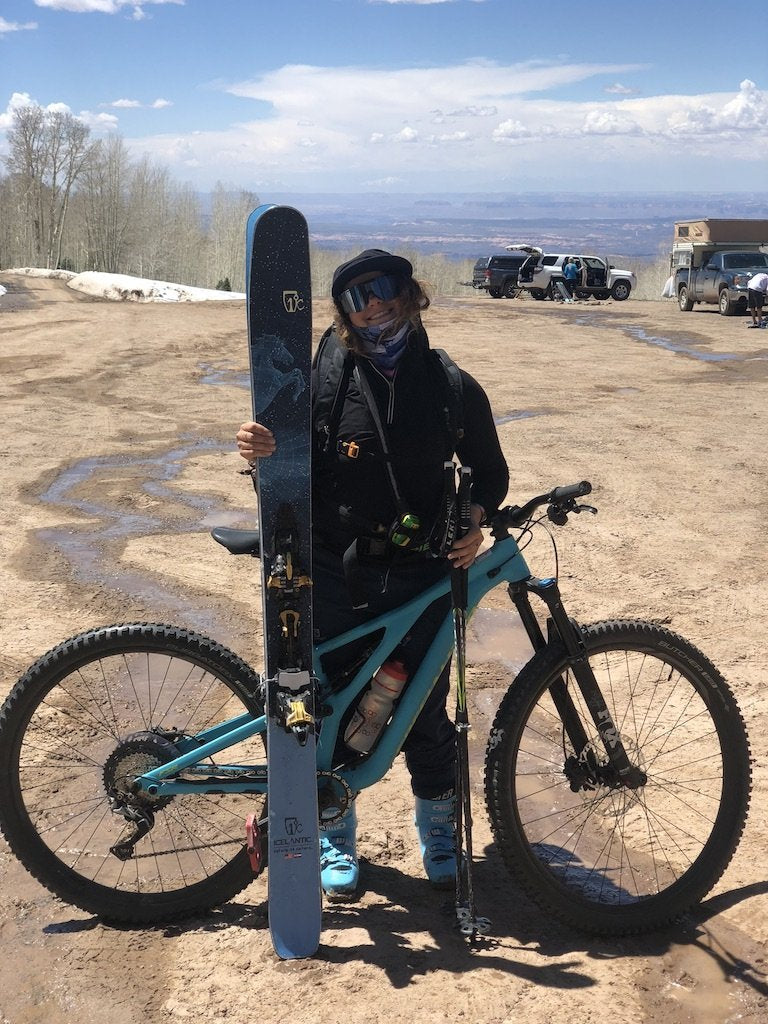
I was anxious to find out. So I set off on a mission to descend from the top of Mt. Tukuhnikivatz at 12,482 feet down to the Colorado River at 4,026 feet with the help of skis, mountain bikes, rafts, and gravity.
After ample route planning and meal prep, my partner and I hit the skin track off of Geyser Pass road just before 5am. We made a plan to ski the north east bowl of Mt. Tuk and return to the trailhead by early afternoon, fuel up on a big lunch, then hop in the saddle.
After a dark and ice-covered slog on a summer road, the first light of the La Sal peaks was breathtaking. The dawn revealed our surroundings, and we found ourselves amongst snow capped mountains, traveling over what felt like a rolling glacier—yet we still had sight of the red desert floor thousands of feet below.

Skinning in the morning sun
Fueled by maple pocket bacon with Village People blasting from my phone speaker, we booted up the icey northwest couloir and to the summit of Tuk.
We drank a beer and soaked up the summit sun, gazing in awe at the 8,000 vertical foot view of the desert floor.
The sun was high and so was the stoke as we ripped skins and harvested corn back to the trailhead, where we had a van staged with mountain bikes and carne asada fajitas ready to go.
Part two of our multi sport adventure began with a beautiful bike ride through miles of winding back roads. 15 miles of fast descents and painful ascents on pavement came and went, as we marveled at the changes in the ecosystems and climate that we encountered. As we descended closer to the river, the trees became shorter, the animals smaller, and the ground dryer. Smooth red rock replaced the jagged peaks of the La Sals, sand covered the ground instead of snow.

Did you even bike the rim if you didn't pose on this rock?
Once we finally made it to the rim, the real fun began. Classic desert biking at its finest, with miles and miles of slick rock trails and sandy single track. The high alpine adventure just hours before felt like a world away.
By 8pm, we finally reached the river where we had another van staged with our raft ready to put in the Colorado River. With little daylight left and a storm blowing through, we had to swallow our pride and bail on our third and final mission of the multi sport day. Instead, we enjoyed charcuterie for dinner and decompressed our spines after the 10 miles of skiing and 40 miles of mountain biking we clocked in that day.


Thank you to my adventure partner, Zach Ryan for believing in my crazy ideas and keeping the stoked high!
Written by Anna Tedesco


Leave a comment